MapIt!
MapIt! is a Google Maps integration that provides GPS location data for containers, work orders and your drivers. Filter functionality for both work orders and containers lets you drill into the container fleet to find the right dumpster to satisfy your next deal.
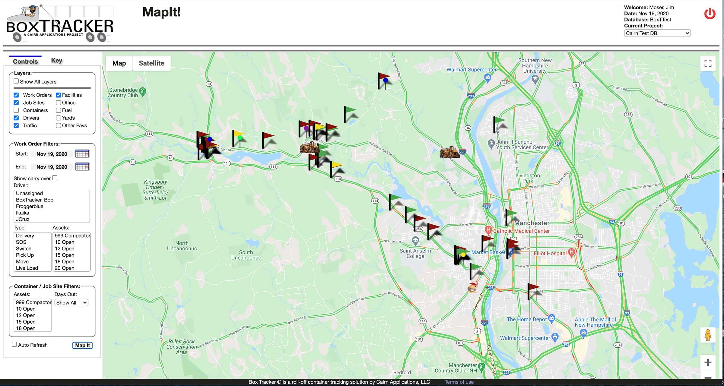
Map Layers:
Work Orders: The work orders layer displays all orders for a given date range as pins on the map. Click the pin to reveal customer information, contact data and order details. You can filter the map by driver, order type, or asset class.
Containers: The container layer displays all of your rented dumpsters. Click the container to reveal customer and job site information and a list of all containers on the job site. You can filter your dumpsters both by asset class and by the number of days that they have been on a job site.
Drivers: The Box Tracker Driver application queries the GPS deck on the driver’s tablet and returns Latitude/Longitude data to the database every 30 seconds. Drivers show up as a Box Tracker Bob icon. Hover over the icon to display the driver name.
Traffic: the traffic layer color codes roadways based on traffic volume. Red indicates a traffic jam, orange a slowdown and green is wide open. Use the traffic layer to direct your drivers around a back up!